SAVING THE SOUND: Bight Board Recommends Long-Term Deal for Buffett’s Historic Studio KONK Life Editor, July 18, 2026
Far above the Earth, NASA’s Apollo lunar lander put astronauts on the moon KONK Life Editor, July 18, 2026
Judge Jones Sentences Defendant for Battery on a Law Enforcement Officer KONK Life Editor, July 17, 2026
DOH-Monroe, Guidance/Care Center, and Monroe County Coalition Distribute Free Narcan Kits During Revive Awareness Day KONK Life Editor, July 17, 2026
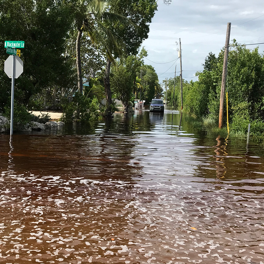
City News MONROE COUNTY IS UNDERWAY WITH PLANNING AND MODELING FOR ROAD ELEVATION PROJECTS IN VULNERABLE AREAS SHARE ON: KONK Life Editor — September 5, 2019 MONROE COUNTY IS UNDERWAY WITH PLANNING AND MODELING FOR ROAD ELEVATION PROJECTS IN VULNERABLE AREASAlready a subscriber? log in. This story is free for you Create a free account and get more of KonkLife's top stories directly to your inbox. Email Password Or, subscribe for unlimited access


No Comment