Street Markings are Official
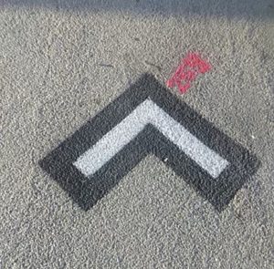
 City officials have been receiving questions regarding the chevron-shaped markings on some Key West streets. They are part of a road elevation survey to help us better plan, prioritize, and budget elevation projects.
The City has been working with Wood Environmental and Infrastructure Solutions, Inc. on a LiDar survey. LiDAR stands for Light Imaging Distance and Ranging. The process helps create maps that are an important groundwork for the City’s Climate Adaptation Plan.
The effort is part of a larger strategy to strengthen and harden the City’s infrastructure and facilities in accordance with anticipated sea level rise as well as storm surge and flooding. Staff is already preparing to use the data to further stormwater, tidal, and sea level rise planning projects.
The markings are temporary and are used to help the scanners match images together to enable a centimeter’s accurate picture of our road elevations.
To stay up to date on the City’s Climate Adaptation Plan, go to www.cityofkeywest-fl.gov and look for the notify me button. From there you can sign up to receive updates via email.


No Comment