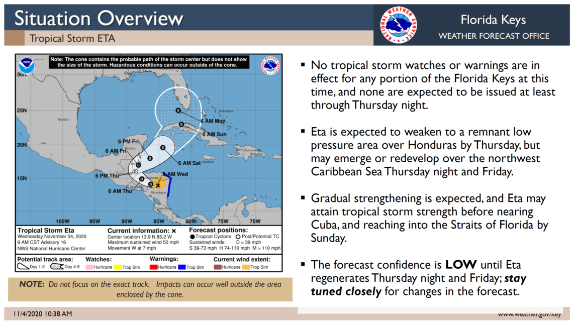
EMERGENCY MANAGEMENT MONITORS TROPICAL STORM ETA WITH THE SYSTEM LIKELY AFFECTING THE FLORIDA KEYS THIS WEEKEND
 MONROE COUNTY, FL – Monroe County Emergency Management will continue to monitor Tropical Storm Eta in conjunction with National Weather Service Key West. The track and intensity of Eta continues to be highly uncertain. The National Weather Service’s Jon Rizzo says he is less concerned about the track, which shows the center of the system, and more concerned about how far the weather will extend from the center when it reaches the Florida Keys. The earliest expected tropical storm weather could be Saturday evening, but tropical storm conditions would most likely start Sunday morning.
“The structure of Eta does not lead to intense strengthening, but there will be a variety of threats like tides a foot higher than the Florida Keys are experiencing right now, especially on the oceanside, and a significant risk of tropical storm force winds,” said Rizzo on Wednesday morning.
Greater certainty of the storm will not be known until Friday, but Monroe County Emergency Management Director Shannon Weiner said this is a good time to make plans to batten down the hatches for this weekend with an expectation of potentially damaging wind gusts up to 65 mph.
According to the National Weather Service Key West, the conditions are not conducive for rapid intensifications or for Eta to become a hurricane before it reaches the Florida Keys. Eta is also not expected to pose a life safety concern and no evacuations or additional protective measure are being considered at this time, but that could change with additional briefings with the National Weather Service Key West. Additional information regarding Eta will be released tomorrow.
[livemarket market_name="KONK Life LiveMarket" limit=3 category=“” show_signup=0 show_more=0]


No Comment