Streets for People / What’s Old is New Again – Two New Bike Trails Take Us Back in Time to a Simpler Key West
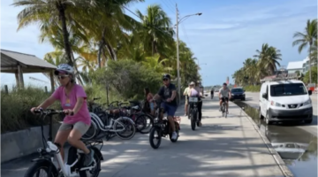
Chris Hamilton. (Featured picture by Britt Myers, Keys Weekly)
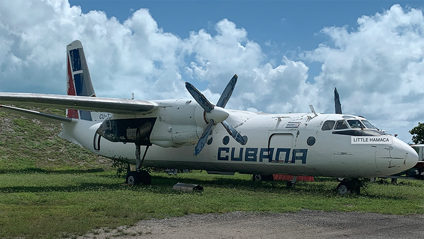
Do you know where the Cubana Plane, once used by Cuban defectors in an attempt to reach the U.S., is? It’s parked along Government Road behind the airport and next to Little Hamaca Park and the Salt Ponds. Still confused? That’s because few people use Government Road these days. But that could change if the road gets incorporated into two new proposed bike trails, that it turns out, aren’t really that new of a concept.
New Trails Start with Planning
Here’s something novel for Key West. Someone on City staff is actually trying to follow and implement an adopted plan. Maybe we’re being unfair to City Hall. Letting community driven plans, written by big-name consultants, sit on shelves and grow old and musty, happens in a lot of places. So, color us impressed that the City’s wonky multi-modal transportation coordinator is trying to both get some quick wins on the ground so people see progress AND begin planning today for some longer-term projects that will take more time to bear fruit.
We’re speaking of course about the Engineering Department’s Multi-Modal Transportation Coordinator Timothy Staub’s charging ahead with implementing the City’s, Key West Bicycle and Pedestrian Master Plan, adopted in February, 2019. A couple months ago, we brought you the feel-good story of Mr. Staub and a band of volunteers constructing the first phase of the Crosstown Greenway (Volunteers and a Little Green Paint Show How We Can Make it Safer to Bike, January 29, 2021). The Greenway, an element of the Bike Plan, was a nice little victory to show people some quick, easy and inexpensive ways to put paint on the street and make it safer for cars and bikes.
Tim recently released to the Sustainability Advisory Board and City Commission a straightforward, easy-to-read Transportation Report 2021 that outlines what he and others on City staff are prioritizing to do regarding transportation in the next 12 months. There’s a dozen plus planning, construction and service projects mentioned covering bike, walk and transit from the respective Bike/Ped and Transit Plans. Over the next couple months, we’ll revisit this subject and hope to highlight some of the exciting projects. Two projects in particular caught our attention for their novelty and daring and because for some people they recall a forgotten era before tourism took over our town.
Salt Ponds and Smathers Beach Trails
Connectivity in the Bike Plan is a big deal. Nothing is worse than a bike trail that ends without a safe way to continue on to your destination. Or a bike lane that is one block long. It also means connecting people from where they live to where they work, shop and play. If people don’t perceive a convenient (think: easy, short, direct) AND safe way to bike somewhere, they’ll find another way. They’ll drive. They’ll call an Uber. They might take the bus – in other cities, but not here in Key West because our transit is so abysmal – but that’s a whole other story). Or they won’t take some trips at all – and that’s bad for our Mom-and-Pop shops. The Salt Ponds and Smathers Beach Trails aim to both provide convenient and safe connections that entice more people to use a bike to get from A to B.
Salt Ponds Trail
The better named Salt Ponds Trail, called the Airport Connector Trail on page 65 of the Bike Plan, would connect the communities of Ocean Walk, Las Salinas and Seaside, where a lot of the city’s workforce lives, with downtown via a time-saving and safer bike trail. This new facility would cut behind the backside of the Key West International Airport, with the ideal design being a wide boardwalk or something with limited disturbances of nature, to Government Road where it would cross Flagler Avenue at 7th Street and then connect up with the Crosstown Greenway. This short-cut between downtown and these uptown communities, would take riders through the middle of town and the salt ponds, rather than out and around S. Roosevelt Boulevard. It could save bikers 10+ minutes. Don’t underestimate the difference between a 20-minute and 30-minute commute, especially when the 30-minute commute is often windswept in at least one direction along the beach.
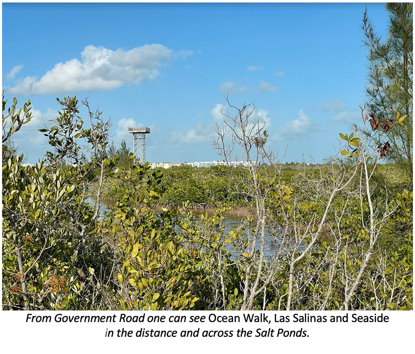
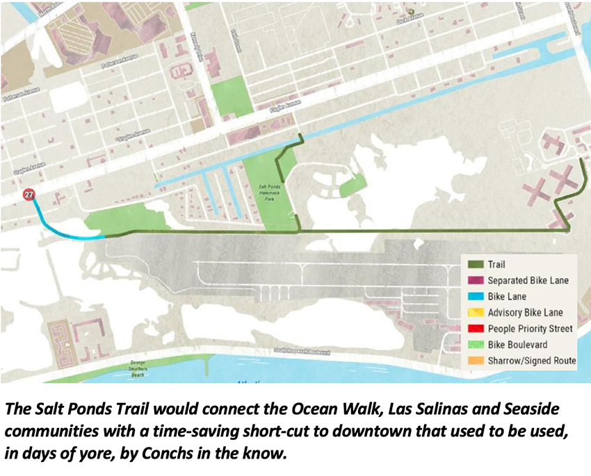
But it seems this new trail isn’t such a new idea after all. In fact, more than 20 years ago, those “in the know Conchs” knew of and used the trail.
Tom “the Bike Man” Theisen, owner of BikeMan Bike rental Key West, tells us that he worked with Key West Bicycle Coordinator Jim Malcolm, who held the job from January 1999 until his death in November 2008, on the Salt Ponds idea including holding meetings and mapping a path. There already was a defacto path people used. “You could walk back there, and kids would ride bikes and play paintball.” In the early 2000’s Mr. Malcom wanted to formalize it.
He tells us “the path from behind the salt ponds was complicated because the Sunrise Suites people didn’t want anyone going past their property.” He went on to explain that there is apparently an agreement that the city can have access through an easement to the Salt Ponds but because the Sunrise Suites objected, the project stalled. Even though nothing happened with the planning effort, “The area was accessible for a long time after that.”
The Bike Man goes on to say that over the years, fences and some channels were dug to prevent access. He ends with: “A connecting path is of course very logical and could be used for recreational purposes as well (as a good commute short-cut), cheap to implement too.”
Smathers Beach Trail
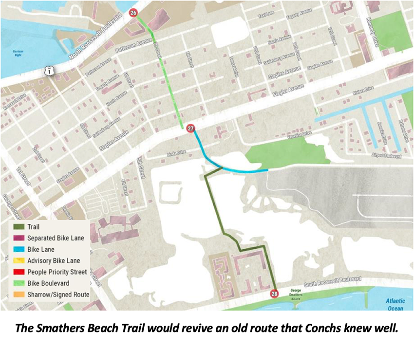
The long-term goal for the Smathers Beach Trail (page 69 of the Bike/Ped Plan) is to allow the High School to connect as well allowing students to have another path that doesn’t involve Flagler. It can better connect New Town residents to Smathers without having to travel along Bertha or go all the way around past the Cow Key Channel and airport. The proposed trail also lines up with FDOT’s proposed HAWK light pedestrian crossing.
Says Bike Man Tom Theisen: “The whole area where the Cuban plane currently sits was open to the public, people drove out there and had their lunch etc. It was a nice space, and it was the start of a trail to Smathers Beach. The trail ran along the runway fence and ended at the bridal path close to the big concrete block (known as the Key West by the Sea condominium). It was easy to bike, though not paved. One day the city came in and put up a fence claiming people where dumping and that was the end of it. Years later they cut a channel where the path was so now a bridge would be needed to restore it.”
Will the Future Mimic the Past?
During the community meetings and public surveys in preparing the Bicycle and Pedestrian Master Plan people remembered these old paths and got them put into the document. Good for them!
Mr. Staub points out that: “The trails are going to be a long-term project that will probably take a few years to accomplish, which is why we want to start planning them now. It’s going to require a ton of environmental work, and partnering with FAA, School Board, County, and State land is involved too.”
Former City Manager Greg Veliz was said to be a champion of these trails because it revives routes that many Conchs used to use to wander through the Salt Ponds. Maybe they were on to something with these paths in the old days. Times were simpler and people expected common sense and practicality to prevail over other considerations.
We applaud the Multi-Modal Transportation Coordinator for pulling these off of the Bike/Ped Plan and starting the planning for the two trails in the next 12 months. As Tom Theisen says: “If the city wants to reduce automobile traffic the paths should be at the top of the list.”
Amen. Let’s get these done!
# # #
You can find all the KONK Life Streets for People column articles here and recent stories below:
- Do Key West Commercial Areas Need Business Improvement Districts (BIDS)? – Part 2: What BIDS in Key West Might Look Like, April 23, 2021
- Do Key West Commercial Areas Need Business Improvement Districts (BIDS)? – Part 1: What’s a BID?; April 16, 2021
- The Good, the Bad and the Ugly – A Dozen Marketing Things KW Transit Can Do to Increase Ridership; April 9, 2021
- The Sorry State of Key West Bus Stops – We Just Don’t Care; April 2, 2021
- It’s Time to Reconsider a Road Diet on S. Roosevelt and Make the Promenade and Road Safer; March 26, 2021
- Getting the Parking Right Leads to Streets for People – Part 2: Battling Our Inner George Costanza – Ten Things We Can Do in Downtown Key West to Get the Parking Right; March 19, 2021
- Getting the Parking Right Leads to Streets for People – Part 1: Nobody Goes there Anymore. It’s Too Crowded – Six Reasons for Right Pricing Parking; March 12, 2021
- Eight Things We Can Do to Pedestrianize Duval and Still Allow Cars, March 5, 2021
- How We Get Wider Sidewalks Downtown Without Ripping Up the Streets – Parklets; February 26, 2021
- The Wee Donkey, Whataboutism, Bathwater and Duval Street’s Future; February 19, 2021
- Averting E-Bike Mayhem and Making Key West Sidewalks Safer; February 12, 2021
- Sustainability Board Wants to Make Free, Frequent and Simple Key West Transit a Reality, February 5, 2021
- Volunteers and a Little Green Paint Show How We Can Make it Safer to Bike; January 29, 2021
Chris Hamilton is founder of the local advocacy group Friends of Car-Free Key West & Duval Street/Historic Downtown. He’s a native of the District of Columbia, where for a couple decades+ he led nationally renowned efforts promoting transit, bike, walk and smart growth for Arlington County, VA’s DOT. Chris has lived in Key West since 2015. He lives downtown and works and volunteers for a couple non-profits.
[livemarket market_name="KONK Life LiveMarket" limit=3 category=“” show_signup=0 show_more=0]




No Comment